Flight to the Windy City

Camping at Cushing Airfield
The landscape beneath me changed. Gathering water from lower Canada and 31 American states, the Mississippi River drains a region the size of India. With a floodplain a thousand miles wide, it’s hard not to be impressed. From this altitude I could practically feel water trickling from the slopes of the eastern Rockies and western Appalachia toward this primordial divide.
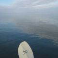
Flying solo in a microlight trike over a Missouri shipping town, thoughts of explorers, steamboats and old-fashioned commerce popped into my head. The river 2,000 feet below has been the backbone of the New World since the Conquistadors came hunting gold in the 1540s. Born just twenty miles from my position, Mark Twain piloted steamships up and down this waterway as a young man—the muddy currents inspiring Tom Sawyer and Huckleberry Finn later in his life. Staring down at the bridges and diesel-powered barges, I found myself humming CCR tunes as a new state welcomed from the other side.

Crossing the Mississippi
The trip to Newark, Illinois has been percolating in my head since I started flying trikes five years ago. Located just outside Chicago airspace, Newark is home to Trikefest, a celebration for powered hang gliding enthusiasts from across the United States. Every year Cushing Airfield in Newark provides a gathering spot for hardcore trikers en route to the famous Wisconsin air show at Oshkosh.
But prior commitments meant my trip to Trikefest and Oshkosh would have to wait another year. Nonetheless, even if it meant I’d have to go early and miss the party, a trip to Cushing Airfield would serve as a satisfying summer adventure. A few scheduling conflicts were not going to hamper my visit to the Holy Land.
Enthusiasm aside, flying to the top of Illinois from my home in the Arkansas mountains 500 miles away seemed daunting—especially in a trike with a cruise speed of only 40 knots. I wasn’t sure what skills were required, nor was I sure if my little 50-horse machine could cut the mustard. But after watching Oliver Aubert and Mike Blyth fly these robust contraptions from Argentina over the frozen North Atlantic to Africa's southern tip in the documentary South to South, inspiration was not hard to find.
What was a challenge was getting everything together. It took several evenings of tinkering with Google Earth and studying aeronautical charts to piece a workable route together. With no onboard radio and several controlled airspaces to avoid including St. Louis and Chicago, I began scribbling a list of non-controlled airports on the back of a used envelope. Working vigilantly like a kid with an Ovaltine Secret Decoder, the prospective route eventually revealed itself.
Next was selecting a suitable window for the trip. With hurricane season brewing in the Gulf of Mexico, there was a lot of moisture pushing into Arkansas and along the intended route. This could be bad, as it adds to the buildup of afternoon thundershowers. But it could also push favorable southerly winds all the way to the top of Illinois.
While secure in my backcountry landing abilities in the event of afternoon showers, I worried what the return flight to Arkansas would be like against strong southerly winds. But forecasters predicted a mild front would pass over Chicago in a few days, possibly bringing tailwinds from the north to get me home. Knowing the trip may have to be abandoned at any moment, it was time to make an attempt.

The Mulberry River
On the morning of Wednesday, July 14th, I strapped a backpack and two extra gas jugs to the trike, kissed my lovely wife goodbye and climbed aboard. With a tug of the starter-rope the delta wing aircraft came to life. Moments later I taxied across the hayfield onto the grass runway at Byrd’s Adventure Center. Within minutes the Mulberry River unfolded below.
The first challenge was to climb out of the forested hillsides of the Mulberry Valley and head north toward the Missouri line. Fog and low clouds had been present during the morning and had delayed departure. Now things were opening up, but I needed a bigger hole in the sky to escape over the 2,400-foot pass at Hare Mountain. After circling above Mountain Creek for several minutes, the clouds dispersed enough to make the maneuver possible.

Hare Mountain
Once beyond the gravity of home things started moving quickly. With the wind at my back, the sky continued clearing and the air became less soupy. Flying north to the White River at the hamlet of St. Paul, it was easy to trace the tributaries of Fleming and Baldwin creeks as they split the mountain south of town. I hopped the Pettigrew divide twenty minutes into flying and dropped into the headwaters of War Eagle Creek. Staying low over tranquil creek-side farms, I flew north until the limestone cliffs appeared along the outskirts of Huntsville.

The White River

War Eagle Creek
Gradually the Ozarks north of Huntsville began changing character. The jagged sandstone peaks to the south gave way to rolling tree-covered hills made of chert and limestone. Dropping in along the Kings River, sloped clearings appeared on the mountainsides that would make nice landing spots for my trike. They reminded me of bush-flying photos from the Idaho backcountry.

Idaho-style Ozarks
As I approached my first stop at Berryville, Arkansas, 50 miles north of my starting point, there was nothing but blue skies and scattered fair weather puffs. The wind was gathering strength from the south and I had to be on my toes while landing at the Berryville airport. The managers, Sheila and Perry Evans, were welcoming and genuinely interested in my journey, as were several pilots I spoke with at this busy little strip. Perry told me about his Super Cub airplane as he gave me a ride to town in his pickup for some last minute supplies. I appreciated his bush-flying tales and words of encouragement.
With a strong tailwind, the next leg of the trip took me across Table Rock Lake, the large resort area splitting the Arkansas-Missouri line near Branson. I stopped at the Hollister Airport for a cup of coffee and the manager offered a free Missouri aeronautical map. From there I proceeded northeast along Beaver Creek to the hamlet of Ava, Missouri, where I landed at an airport that houses the local fire station. Nobody was around so I took off in hefty crosswinds and proceeded to the Mountain Grove airport just a little further up the route.

The Kings River
Here I met professional aviation photographer Henrietta Christensen and her friends Juanita and Larry Darter from Arkansas. What a great flying community this airport boasts, with plenty of interesting airplanes, cold sodas and good conversation. Larry gave me a ride into town to search for auto fuel for my trike and a burger for my empty stomach. It was the first fill-up since I left home 150 miles earlier. When we returned, Henrietta offered expert advice on the route.
The next leg of the flight covered diverse country. Missouri is full of ancient sea-deposited limestone and earth-borne granite, two dissimilar types of rock. Both were visible along the Gasconade River as I followed it northwest around restricted military airspace. This was the terrain described by explorer Henry Schoolcraft as he made his legendary Missouri expedition in 1819.
Eventually a high, treeless plateau appeared with steep-sloped hills. A distinct change from the forested terrain I had been flying over, this looked like a rolling grassland somewhere in Africa. For several minutes I skimmed over cattle trails along the ridges of this exotic landscape. The fantasy ended when trees reappeared to the north, and things were back to normal by the time the airport at Lebanon, Missouri, came into view.
By evening I had made the halfway point at Linn, Missouri, 250 miles from home. Saddle-worn and eager for dinner, I landed at the local airport and wandered on foot to a small-town eatery as the sun went down. By the time I returned and set up my tent the humid night air had become intolerably stagnant. As I crawled in for the duration, mosquitoes swarmed the netting of my shelter and sweat rolled off my forehead. Tossing feverishly for hours on top of the sleeping bag, I was finally camping under wing and loving every minute.
To be continued…